Climate Data for Latitude 35.75 Longitude 14.25

Köppen climate classification: Csa (Climate: warm temperate; Precipitation: summer dry; Temperature: hot summer)
 

Locations

Download
Buskett - Girgenti Area
Filfla
Filfla islet
Il-Bahar bejn Rdum Majjiesa u Ras ir-Raheb
Il-Ballut tal-Wardija (l/o San Pawl il-Bahar)
Il-Gzejjer ta' San Pawl / Selmunett
Il-Maqluba (l/o Qrendi)
Is-Salini
Is-Simar (l/o San Pawl il-Bahar)
Ix-Xaghra tal-Kortin
L-Ghadira Area
L-Ghadira s-Safra
L-Ghar ta' l-Iburdan
L-Imgiebah / Tal-Mignuna Area
Pembroke Area
Ramla tat-Torri / Rdum tal-Madonna Area
Rdum Tal-Madonna
Rdumijiet ta' Malta: Ir-Ramla tac-Cirkewwa sa Il-Ponta ta' Benghisa
Wied il-Mizieb

Averages (English) Metric

TypeUnitsJanFebMarAprMayJunJulAugSepOctNovDecPeriod
Min Temp49.049.050.854.159.265.770.471.969.364.157.752.0109 years
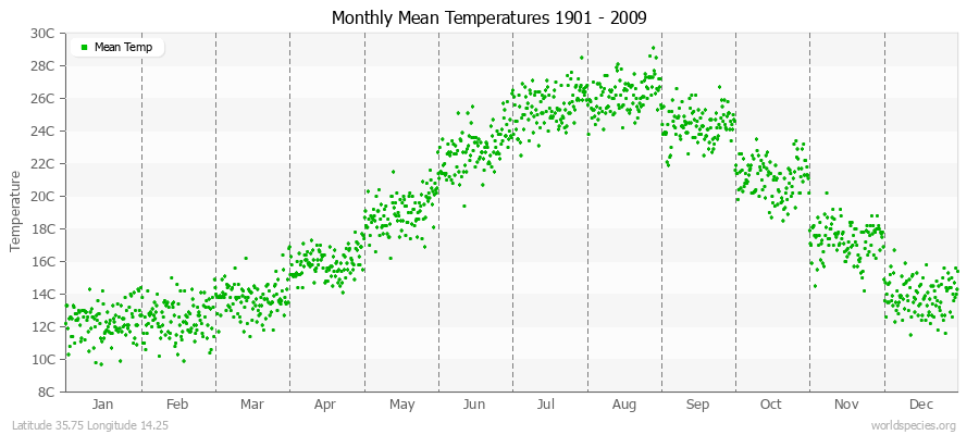
Mean Temp54.154.556.760.666.273.177.979.275.970.063.257.0109 years
Max Temp59.360.062.667.173.280.685.586.682.576.068.862.1109 years
FrostDays11.08.23.20.44.52.54.83.01.83.79.23.66 years
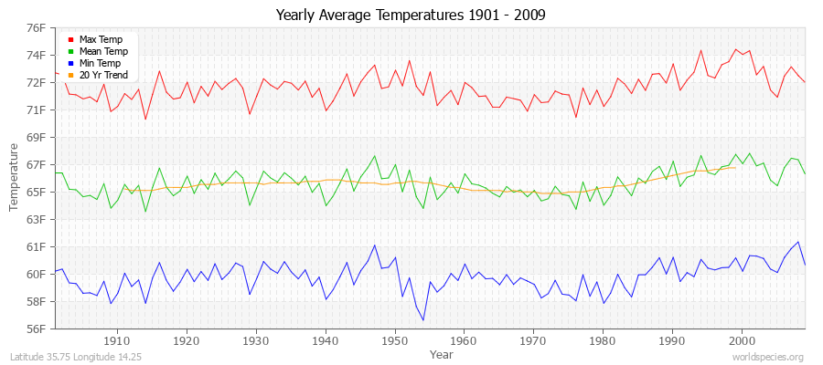
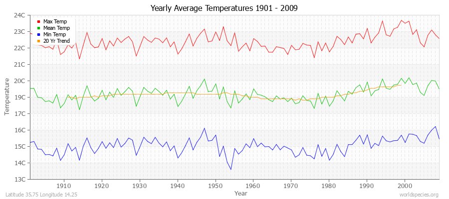
Yearly Average Temperatures 2010 - 2009 (English) Latitude 35.75 Longitude 14.25
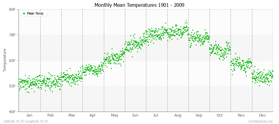
Monthly Mean Temperatures 1901 - 2009 (English) Latitude 35.75 Longitude 14.25
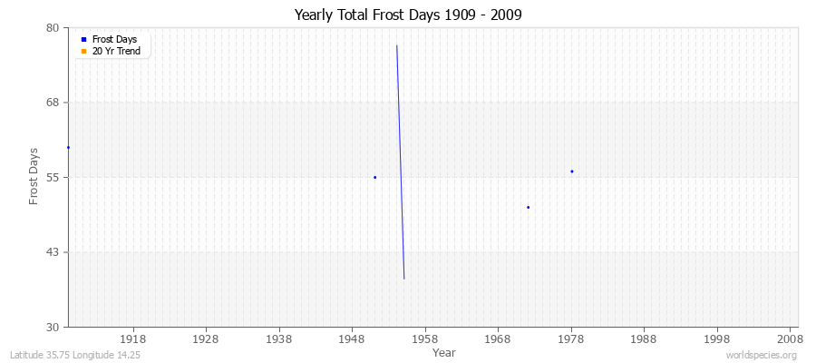
Yearly Total Frost Days 1909 - 2009 Latitude 35.75 Longitude 14.25

Climate data provided by CRU TS 3.1 - University of East Anglia Climate Research Unit (CRU). [Phil Jones, Ian Harris]. CRU Time Series (TS) high resolution gridded datasets, [Internet]. NCAS British Atmospheric Data Centre, 2008, Accessed: 28-July-2011
Charting software provided by pChart - a PHP class to build charts.
Köppen climate classification provided by Kottek, M., J. Grieser, C. Beck, B. Rudolf, and F. Rubel, 2006: World Map of Köppen-Geiger Climate Classification updated. Meteorol. Z., 15, 259-263
The calculation method for the potential evapotranspiration is the FAO grass reference equation (Ekstrom et al., 2007, which is based on Allen et al., 1994). It is a variant of the Penman Monteith method using TMP, TMN, TMX, VAP, CLD.