Climate Data for Latitude 54.75 Longitude 11.75Köppen climate classification: Cfb (Climate: warm temperate; Precipitation: fully humid; Temperature: warm summer) Bøtø Nor
Guldborgsund
Hyllekrog-Rødsand and Fehmarn Belt
Krenkerup Haveskov
Listrup Lyng
Maltrup Skov
Maribo lakes
Maribosøerne
Smålandsfarvandet nord for Lolland, Guldborg Sund, Bøtø Nor og Hyllekrog-Rødsand
Smålandshavet nord for Lolland
Ulvsund, Grønsund, Farø Fjord and Fanefjord
|
Averages (Metric) English| Type | Units | Jan | Feb | Mar | Apr | May | Jun | Jul | Aug | Sep | Oct | Nov | Dec | Period |
|---|
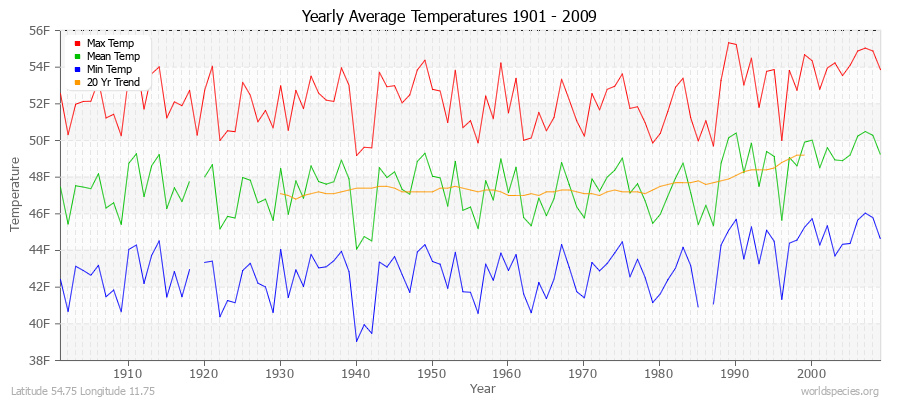
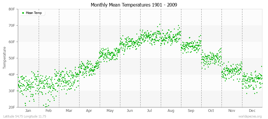
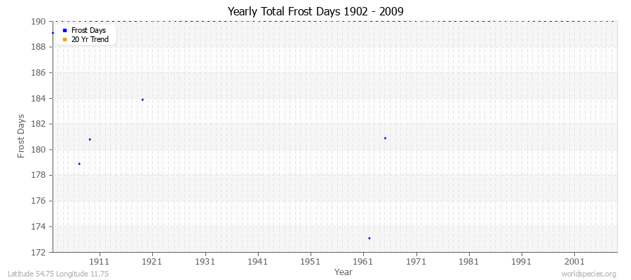
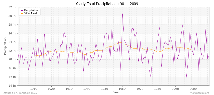
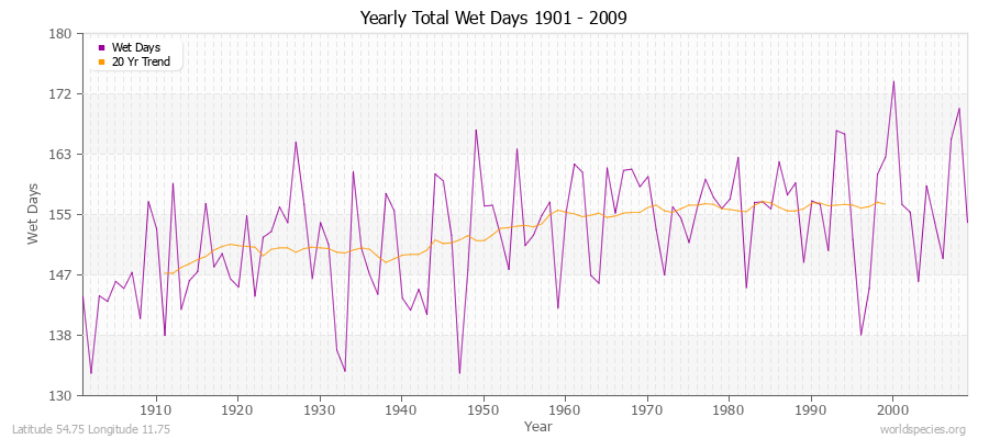
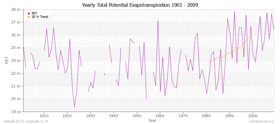
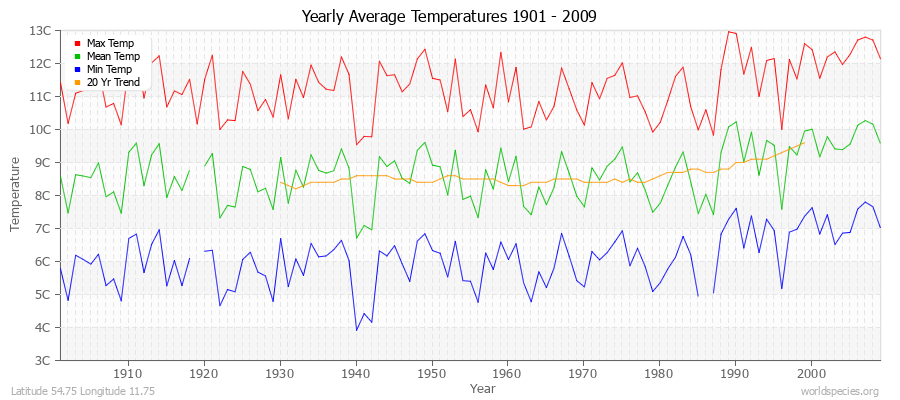
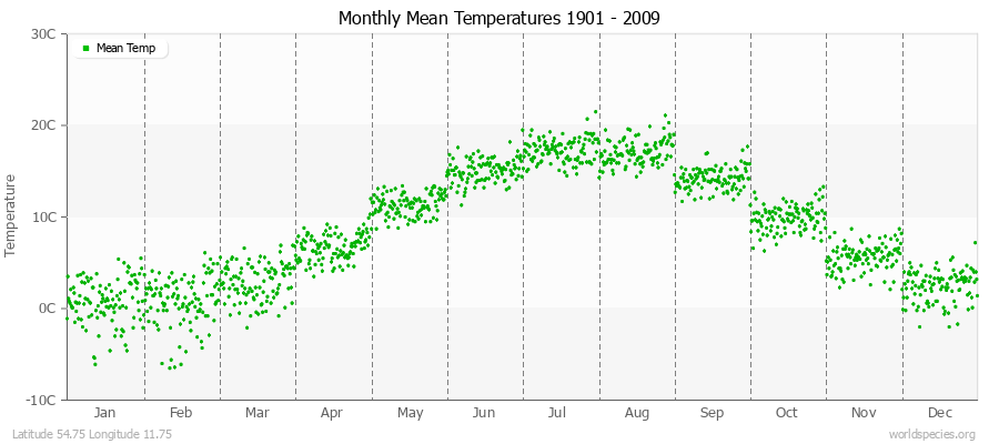
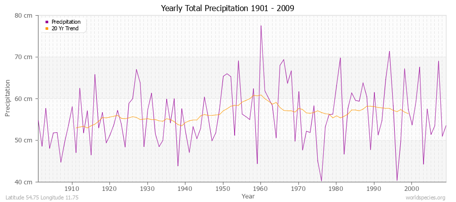
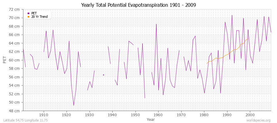
| Min Temp | C° | -1.1 | -1.1 | 0.5 | 3.7 | 7.8 | 11.8 | 14.1 | 14.0 | 11.4 | 7.5 | 3.7 | 0.7 | 107 years | | Mean Temp | C° | 0.8 | 0.7 | 2.9 | 6.7 | 11.3 | 15.1 | 17.3 | 17.1 | 14.2 | 9.9 | 5.6 | 2.4 | 108 years | | Max Temp | C° | 2.6 | 2.6 | 5.3 | 9.8 | 14.9 | 18.4 | 20.5 | 20.2 | 17.0 | 12.3 | 7.5 | 4.2 | 109 years | | Frost | Days | 30.6 | 28.0 | 31.0 | 10.6 | 6.7 | 7.5 | 1.8 | 1.8 | 1.6 | 10.1 | 20.3 | 31.0 | 6 years | | Wet | Days | 17.9 | 11.1 | 12.8 | 11.2 | 9.5 | 10.3 | 12.1 | 12.6 | 11.0 | 12.2 | 16.7 | 15.1 | 109 years | | Precipitation | mm | 43.5 | 33.5 | 32.5 | 34.7 | 41.6 | 48.8 | 63.8 | 59.7 | 50.4 | 46.5 | 56.9 | 49.0 | 109 years | | Potential Evapotranspiration | mm | 11.1 | 13.1 | 28.0 | 51.5 | 85.4 | 98.0 | 104.7 | 89.8 | 58.5 | 32.2 | 17.3 | 11.1 | 95 years |
Averages (English) Metric| Type | Units | Jan | Feb | Mar | Apr | May | Jun | Jul | Aug | Sep | Oct | Nov | Dec | Period |
|---|
| Min Temp | F° | 30.1 | 29.9 | 32.9 | 38.7 | 46.0 | 53.2 | 57.5 | 57.2 | 52.5 | 45.5 | 38.7 | 33.3 | 107 years | | Mean Temp | F° | 33.4 | 33.3 | 37.3 | 44.1 | 52.4 | 59.1 | 63.2 | 62.7 | 57.5 | 49.8 | 42.1 | 36.4 | 108 years | | Max Temp | F° | 36.8 | 36.7 | 41.6 | 49.6 | 58.9 | 65.1 | 68.9 | 68.4 | 62.7 | 54.1 | 45.5 | 39.5 | 109 years | | Frost | Days | 30.6 | 28.0 | 31.0 | 10.6 | 6.7 | 7.5 | 1.8 | 1.8 | 1.6 | 10.1 | 20.3 | 31.0 | 6 years | | Wet | Days | 17.9 | 11.1 | 12.8 | 11.2 | 9.5 | 10.3 | 12.1 | 12.6 | 11.0 | 12.2 | 16.7 | 15.1 | 109 years | | Precipitation | in | 1.7 | 1.3 | 1.3 | 1.4 | 1.6 | 1.9 | 2.5 | 2.4 | 2.0 | 1.8 | 2.2 | 1.9 | 109 years | | Potential Evapotranspiration | in | 0.4 | 0.5 | 1.1 | 2.0 | 3.4 | 3.9 | 4.1 | 3.5 | 2.3 | 1.3 | 0.7 | 0.4 | 95 years |
Climate data provided by CRU TS 3.1 - University of East Anglia Climate Research Unit (CRU). [Phil Jones, Ian Harris]. CRU Time Series (TS) high resolution gridded datasets, [Internet]. NCAS British Atmospheric Data Centre, 2008, Accessed: 28-July-2011 Charting software provided by pChart - a PHP class to build charts. The calculation method for the potential evapotranspiration is the FAO grass reference equation (Ekstrom et al., 2007, which is based on Allen et al., 1994).
It is a variant of the Penman Monteith method using TMP, TMN, TMX, VAP, CLD.
|