Warning (2): Division by zero [ROOT/vendor/pchart/pchart/pchart.php, line 514]
Warning (2): Division by zero [ROOT/vendor/pchart/pchart/pchart.php, line 547]
Warning (512): Unable to emit headers. Headers sent in file=/var/www/projects/species/vendor/cakephp/cakephp/src/Error/Debugger.php line=853 [CORE/src/Http/ResponseEmitter.php, line 48]
Warning (2): Cannot modify header information - headers already sent by (output started at /var/www/projects/species/vendor/cakephp/cakephp/src/Error/Debugger.php:853) [CORE/src/Http/ResponseEmitter.php, line 148]
Warning (2): Cannot modify header information - headers already sent by (output started at /var/www/projects/species/vendor/cakephp/cakephp/src/Error/Debugger.php:853) [CORE/src/Http/ResponseEmitter.php, line 177]
World Species : Climate Data for Latitude -52.25 Longitude -59.25

Climate Data for Latitude -52.25 Longitude -59.25

Köppen climate classification: ET (Climate: polar; Temperature: polar tundra)
 

Locations

Download
Bull Point, East Falkland
Sea Lion Islands Group

Averages (English) Metric

TypeUnitsJanFebMarAprMayJunJulAugSepOctNovDecPeriod
Min Temp41.341.639.836.232.229.828.829.031.034.136.739.7103 years
Mean Temp49.049.147.443.439.036.235.336.238.842.144.847.5109 years
Max Temp56.856.855.050.745.842.641.843.446.650.052.955.4109 years
FrostDays16.018.818.827.131.030.031.031.030.028.220.920.8109 years
WetDays14.510.99.812.412.113.713.39.68.112.313.418.9109 years
Precipitationin2.41.82.01.91.91.81.61.51.41.41.62.1109 years
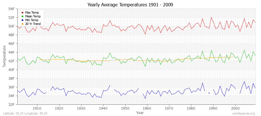
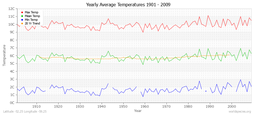
Yearly Average Temperatures 2010 - 2009 (English) Latitude -52.25 Longitude -59.25
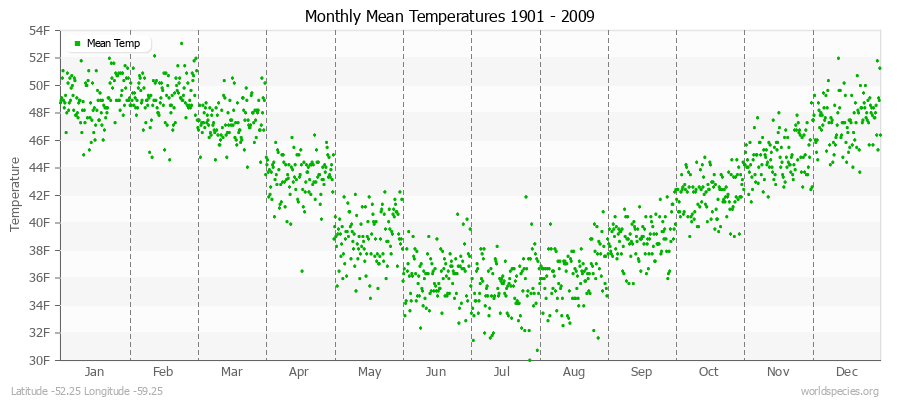
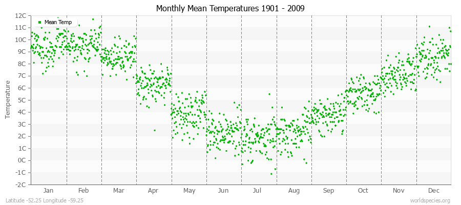
Monthly Mean Temperatures 1901 - 2009 (English) Latitude -52.25 Longitude -59.25
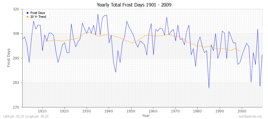
Yearly Total Frost Days 1901 - 2009 Latitude -52.25 Longitude -59.25
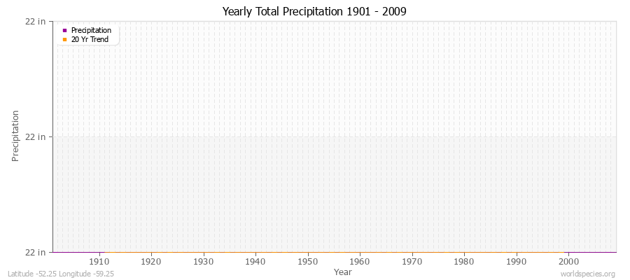
Yearly Total Precipitation 1901 - 2009 (English) Latitude -52.25 Longitude -59.25
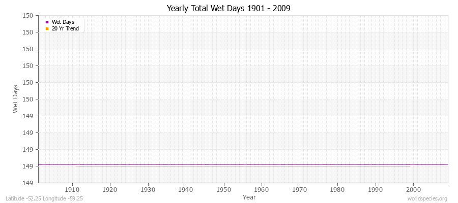
Yearly Total Wet Days 1901 - 2009 Latitude -52.25 Longitude -59.25

Climate data provided by CRU TS 3.1 - University of East Anglia Climate Research Unit (CRU). [Phil Jones, Ian Harris]. CRU Time Series (TS) high resolution gridded datasets, [Internet]. NCAS British Atmospheric Data Centre, 2008, Accessed: 28-July-2011
Charting software provided by pChart - a PHP class to build charts.
Köppen climate classification provided by Kottek, M., J. Grieser, C. Beck, B. Rudolf, and F. Rubel, 2006: World Map of Köppen-Geiger Climate Classification updated. Meteorol. Z., 15, 259-263
The calculation method for the potential evapotranspiration is the FAO grass reference equation (Ekstrom et al., 2007, which is based on Allen et al., 1994). It is a variant of the Penman Monteith method using TMP, TMN, TMX, VAP, CLD.