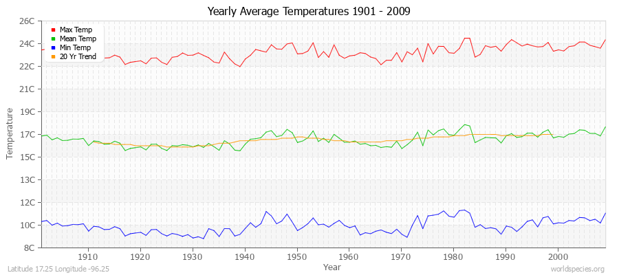
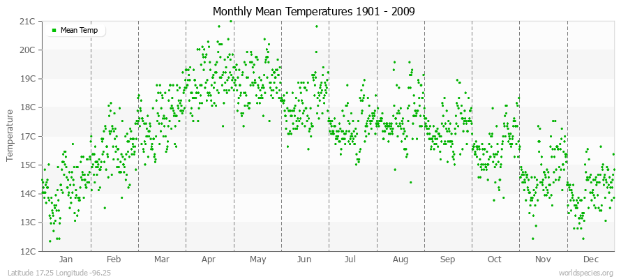
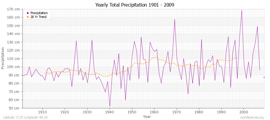
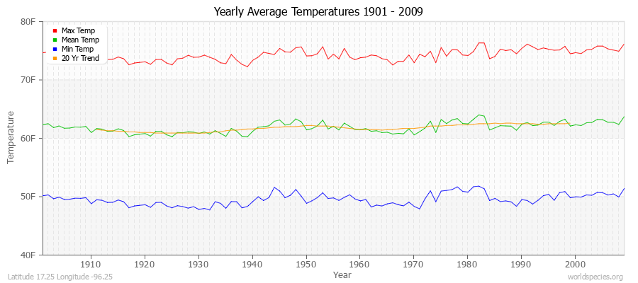
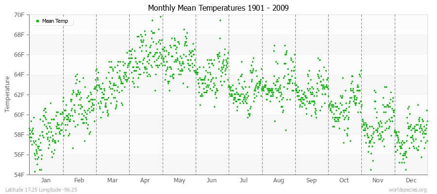
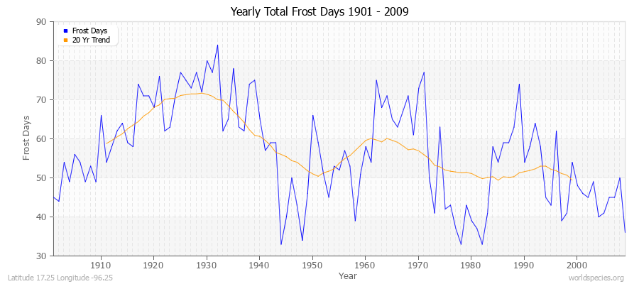
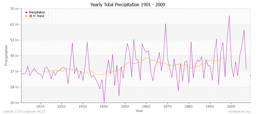
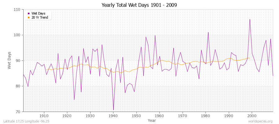
Climate Data for Latitude 17.25 Longitude -96.25

Köppen climate classification: Cwb (Climate: warm temperate; Precipitation: winter dry; Temperature: warm summer)
 

Locations

Download
Sierra Madre de Oaxaca pine-oak forests ecoregion

Averages (English) Metric

TypeUnitsJanFebMarAprMayJunJulAugSepOctNovDecPeriod
Min Temp44.446.048.651.852.753.352.252.552.550.046.344.1109 years
Mean Temp58.060.662.965.865.564.062.463.062.360.959.157.8109 years
Max Temp71.775.377.279.978.474.872.773.772.171.972.071.6109 years
FrostDays10.16.45.31.63.71.71.50.50.76.07.211.9109 years
WetDays1.51.61.42.64.414.819.011.220.07.62.22.0109 years
Precipitationin0.50.70.91.33.67.76.95.46.93.61.00.8108 years
Potential Evapotranspirationin2.52.93.73.73.83.23.13.12.72.92.92.6109 years
Yearly Average Temperatures 2010 - 2009 (English) Latitude 17.25 Longitude -96.25
Monthly Mean Temperatures 1901 - 2009 (English) Latitude 17.25 Longitude -96.25
Yearly Total Frost Days 1901 - 2009 Latitude 17.25 Longitude -96.25
Yearly Total Precipitation 1901 - 2009 (English) Latitude 17.25 Longitude -96.25
Yearly Total Wet Days 1901 - 2009 Latitude 17.25 Longitude -96.25
Yearly Total Potential Evapotranspiration 1901 - 2009 (English) Latitude 17.25 Longitude -96.25

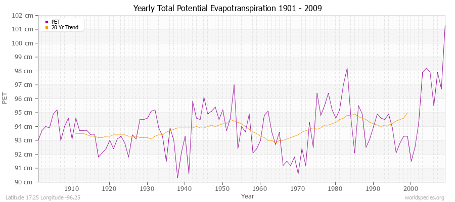
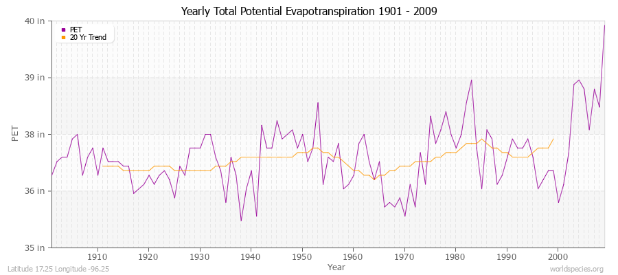
Climate data provided by CRU TS 3.1 - University of East Anglia Climate Research Unit (CRU). [Phil Jones, Ian Harris]. CRU Time Series (TS) high resolution gridded datasets, [Internet]. NCAS British Atmospheric Data Centre, 2008, Accessed: 28-July-2011
Charting software provided by pChart - a PHP class to build charts.
Köppen climate classification provided by Kottek, M., J. Grieser, C. Beck, B. Rudolf, and F. Rubel, 2006: World Map of Köppen-Geiger Climate Classification updated. Meteorol. Z., 15, 259-263
The calculation method for the potential evapotranspiration is the FAO grass reference equation (Ekstrom et al., 2007, which is based on Allen et al., 1994). It is a variant of the Penman Monteith method using TMP, TMN, TMX, VAP, CLD.